by Alejandro Berlanga Alzaga and Valeria Martinez
When you think of drones, you may think of a package getting delivered to your doorstep. Many companies conduct flight missions of drones for delivering goods, but other applications for drones can benefit the public (and commercial vehicle drivers) in another way — travel across the border.

Alejandro Berlanga Alzaga.

Valeria Martinez.
We and our colleagues at the Texas A&M Transportation Institute’s (TTI’s) Center for International Intelligent Transportation Research (CIITR) get to work with the latest technologies in three areas — AI, drones and satellites — and apply them to improving transportation at the border. Recent research allows us to become AI specialists. We explore new AI algorithms, closely monitor trends and note improvement areas and figure out ways to apply them to facilitate trade, improve border security and encourage economic growth in border communities.
You’ve probably seen AI or drone technology depicted in the movies, and that’s built up hype (and often negative hype). But AI technology can help resolve real-world problems today, like achieving more accurate and reliable border wait time estimates at land ports of entry. Longer wait times can mean delays in goods getting to market, and if that delay is long enough, it can even mean spoilage of goods like milk or produce. Combining AI algorithms with satellite and aerial imagery can help facilitate distribution via the border by getting trucks to their destinations more effectively.
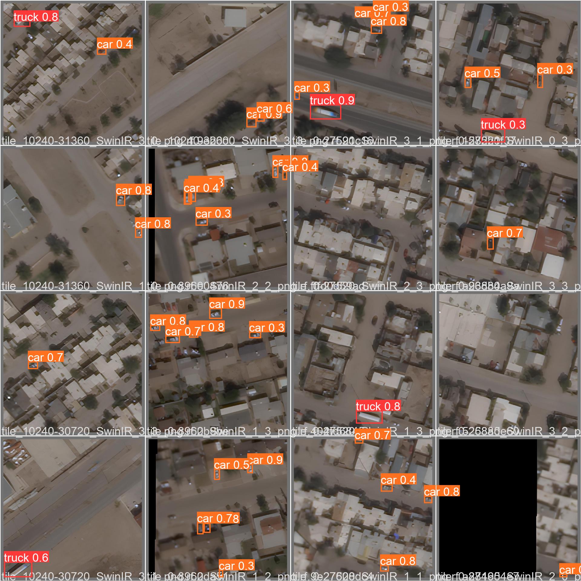
Visualizing results (shown here) after taking satellite images facilitates a better understanding of vehicles at the border and can identify exactly where delays occur.
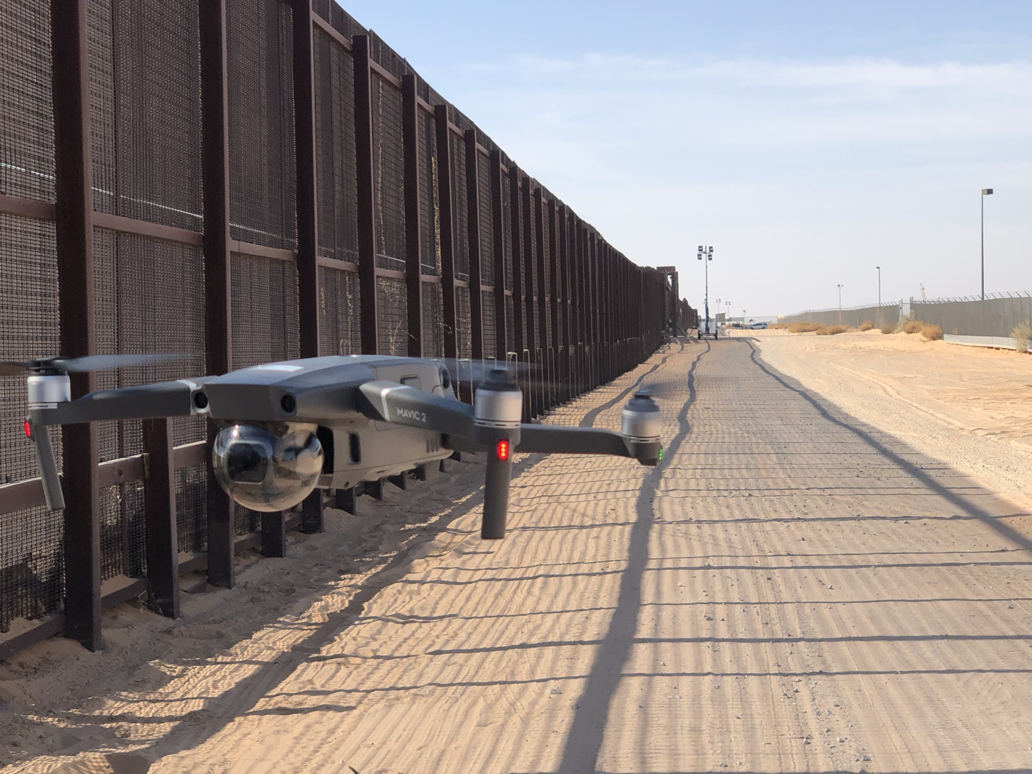
Drones (like the one pictured here) capture aerial images that can provide information about border traffic conditions.
Recent enhancements in satellite imagery, for example, allow for better control of the frequency and number of images collected at border crossings, as well as advanced imaging capabilities. Drones, for example, offer flexibility and dexterity, advantages over cameras and radar sensors installed in fixed locations at the border. Better data help agencies charged with monitoring the border to work more efficiently, and that efficiency is passed downstream, benefiting the entire distribution process. It can even mean lower prices for consumers on store shelves.
To assess these technologies for effectiveness, we collected aerial and satellite images to use in building 3-D models to better visualize the data associated with stalled traffic at heavy wait times at border crossings. Stalled traffic in extreme border queuing conditions can ratchet up costs and travel time. Our research suggests a lower cost and an improved ease of use, which could fit well with agency staff new to (and eager for) these technologies.
Challenges will inevitably arise in implementing these new methods for monitoring the border. That’s why we do our research, to ultimately troubleshoot potential problems in applying new tech solutions to achieve the most bang for the taxpayer’s buck in applying them. Better tech, better methods, better policy benefit manufacturers, distributors and ultimately consumers — everyone wins.
Alejandro Berlanga Alzaga, software applications developer I, and Valeria Martinez, senior research associate, work in TTI’s Research and Implementation Program in El Paso.