by Rafael Aldrete and Swapnil Samant
Transportation agencies are charged with the formidable task of keeping people and goods moving efficiently, reliably and safely. Sometimes, that’s not easy. When bad weather hits, for example, a transportation management agency’s limited resources and personnel are stretched thin by mass movements of cars and trucks stressing the local network.
Given limited funding and rising maintenance costs, every penny and every second count when it comes to keeping people—and economies—moving forward.
In April 2022, the Texas Department of Public Safety implemented enhanced inspections of commercial trucks crossing the border from Mexico with the intent to crack down on drugs entering the United States. One unintended consequence was the miles-long backup of commercial trucks, stymieing shipments of legitimate cargo and adding to already significant, post-pandemic supply-chain shortages. Numerous transportation agencies on both sides of the border faced traffic snarls they hadn’t been able to plan for.

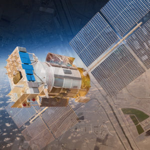
Using artificial intelligence to rapidly analyze large volumes of photos taken by satellites can help transportation management agencies more proactively manage mobility before, during, and after extreme traffic events.
Though costly for businesses and inconvenient for consumers, the situation provided our researchers at the Texas A&M Transportation Institute’s (TTI’s) Center for International Intelligent Transportation Research (CIITR) the rare opportunity to collect satellite images of the bottleneck. We looked at queue lengths and the time it took for trucks to travel from point A to point B. This helped us refine our cutting-edge use of satellite imaging to document, analyze and recommend how to mitigate these kinds of traffic stoppages in the future.
Analyzing traffic backups like this one is how we learn to reduce their impact. But an agency’s ability to learn from extreme traffic events is always limited by the technology used to gather intelligence about them. Using artificial intelligence (AI), we can now review thousands of satellite images, enhance their resolution and extrapolate assumptions about traffic patterns much faster than ever before. Thanks to improved resolution, we can see more detail in every image than ever before. Ten years ago, satellite companies might have taken a week to deliver a requested image; now, they deliver them in a day, and they’re much cheaper than they used to be. In the coming decade, AI will be even more powerful, photo resolution will continue to develop, and image cost will likely continue to decrease.
But not all traffic challenges happen in the daytime. And, as advanced as it’s become, standard satellite imaging is not as effective in low visibility conditions. New technologies, like Synthetic Aperture Radar (SAR), fix that problem by using radar to reflect objects on the ground, bypassing clouds, darkness, or other obstructions.
How does all this fit into the transportation equation? Studying mass-movement events as they happen can help agencies learn where system deficiencies exist and how to troubleshoot them before future events occur. Imagine if Houston’s TranStar traffic management center had had the power of SAR-backed satellite imaging and AI analysis to prepare for Hurricane Harvey’s evacuation in 2017. The National Hurricane Center estimates Harvey caused $125 billion in damage. How much of that might have been avoided with mitigation planning enhanced by advanced traffic trend analysis? How many lives might have seen saved?
First things first: we have to learn how to apply these advanced technologies to meet agency needs, and that’s where TTI research comes in. Transportation technology has always had two essential purposes: to improve mobility and enhance safety. We have an opportunity now to first learn, then teach others how to use the latest imaging and analysis technologies to do just that.
Rafael Aldrete, senior research scientist, is director of TTI’s CIITR based in El Paso, Texas. Swapnil Samant, associate research scientist, is program manager of TTI’s Research and Implementation Program in El Paso.


